Best Drone for Mapping: SenseFly vs. Parrot
In the rapidly evolving world of drones and Unmanned Aerial Vehicle (UAV) technology, finding the best drone for mapping can be a daunting task. Today, we’re focusing on two market-leading options: SenseFly and Parrot.
Understanding Mapping Drones
Mapping drones, also known as survey drones, have redefined aerial surveying and mapping with their ability to capture high-resolution aerial images that can be transformed into detailed orthomosaics and 3D models. This cutting-edge technology is widely employed in various sectors, including agriculture, construction, and environmental monitoring.
SenseFly: A Glimpse into Precision Mapping

SenseFly is one of the most renowned brands when it comes to high-precision mapping drones. Known for their impressive range and incredibly accurate mapping capabilities, SenseFly drones have taken aerial mapping to new heights.
SenseFly’s eBee X: Versatility Redefined
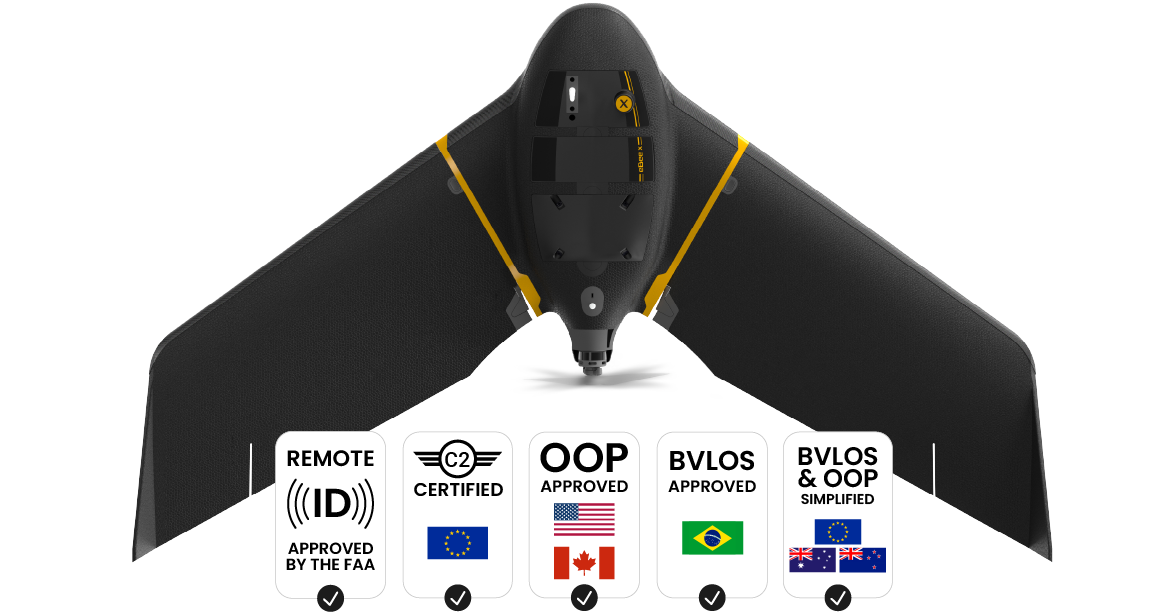
The eBee X by SenseFly is a revolutionary fixed-wing drone designed for long-range applications. It boasts an endurance of up to 90 minutes, covering vast distances of up to 500 hectares (1,235 acres) in a single flight.
This drone also features a series of high-end cameras, including the S.O.D.A 3D for 3D reconstructions and the Aeria X for photogrammetric mapping. Furthermore, the eBee X is equipped with the Steep Landing technology, ensuring safe landings even in the most challenging terrains.
Parrot: Unleashing the Power of Drones

Parrot, a major player in the drone market, has garnered attention with its dynamic range of multi-purpose drones.
Parrot’s Anafi USA: Mapping with Excellence
The Anafi USA by Parrot stands out with its robust design and high-precision mapping abilities. This quadcopter drone is equipped with a 32x zoom 4K HDR camera, capable of capturing high-resolution images and videos.
Additionally, the Anafi USA features a 32-minute flight time, covering a significant area with its automated flight plan. The drone’s data encryption and secure servers further reinforce its position as a reliable choice for sensitive missions.
SenseFly vs. Parrot: A Detailed Comparison
While both SenseFly and Parrot offer outstanding drones, their suitability depends on the specific requirements of a project.
Here is a side-by-side comparison:
| SenseFly eBee X | Parrot Anafi USA | |
|---|---|---|
| Flight Time and Range | Up to 90 minutes, 500 hectares coverage | 32 minutes, coverage varies based on flight plan |
| Camera and Imaging | High-end cameras like S.O.D.A 3D and Aeria X for various applications | 32x zoom 4K HDR camera for high-resolution imaging |
| Data Security | Standard security measures | Enhanced security with data encryption and secure servers |
Flight Time and Range
SenseFly’s eBee X significantly outperforms Parrot’s Anafi USA in terms of flight time and coverage area, making it a superior choice for large-scale mapping projects.
Camera and Imaging
While the eBee X’s camera options allow for various mapping applications, the Anafi USA’s 32x zoom capability and 4K HDR imaging provide more detailed and vivid results, proving more useful in detailed inspections and surveillance.
Security and Data Protection
Both drones offer robust data security; however, the Anafi USA’s explicit focus on data encryption gives it a slight edge in missions requiring higher data security.
Final Thoughts
When choosing the best drone for mapping, both SenseFly and Parrot provide compelling options. SenseFly’s eBee X excels in large-scale mapping, while Parrot’s Anafi USA shines in detail-oriented and security-focused tasks. Ultimately, the choice between the two depends on your specific mapping needs.
